• Home
  • Search
  • Browse Colleges, Departments, and Programs
  • My Account
  • About
  • DC Network Digital Commons Network™
Skip to main content
EWU Digital Commons

EWU Digital Commons

  • Home
  • About
  • FAQ
  • My Account
  • Contact

Home > College, Department, or Program > Archives > SPC > FREEMAN

Otis Willard Freeman Photograph Collection

About this Collection

The Images

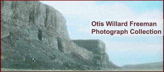
The Otis Freeman photograph collection includes over 500 glass lantern slides, primarily images of the physical geography of the Pacific Northwest, which he used to illustrate his lectures. The digital collection is a sampling of the entire Freeman collection.

A large portion of the collection contains images of the Pacific Northwest. The bulk of these were taken in Washington, but also includes images from Idaho, Montana and Oregon. The collection includes many images of identified geologic features, such as buttes, waterfalls, canyons, lakes and rivers. It also contains pictures of dam sites, including the Grand Coulee Dam, Chief Joseph Dam, Dry Falls Dam, McNary Dam, and Hungry Horse Dam (Montana). The collection also contains slides taken of maps and diagrams of the dams. The photographs illustrate Freeman's interest in regional and human geography with images of people farming, ranching, mining and the effects on the land.

Biographical Note

Otis Willard Freeman (1889-1964), geographer and geologist, was born and raised in Michigan. He received his A.B. at Albion College, 1910, his M.S. in geology from the University of Michigan in 1913 and his Ph.D. Clark in 1929. He was married to Laura Cowell in 1914 and they had four children, though only two daughters survived.

Freeman came to the Cheney State Normal School (now EWU) in 1924 as a teacher of geography and geology. He had several leaves of absence from Eastern and taught at the University of Hawaii and at Indiana University. He also taught summer sessions at San Francisco State College, Western Reserve University, Reed College and the University of Washington. While teaching at Eastern, he was a strong proponent of field work, and took his students on trips to Illinois, Arizona, California, Hawaii and Alaska, as well as trips throughout Washington and Oregon. In 1932, he was made head of the Physical Science Dept. at Eastern and served in that capacity until the death of Walter W. Isle in 1951, when he was appointed acting president. He resigned as president in 1953.

He was the author of over 100 articles, books and other publications. He was also the geography editor of the Education magazine and published many essential textbooks on Geography and Geology. He died in 1964.

Printing is not supported at the primary Gallery Thumbnail page. Please first navigate to a specific Image before printing.

Follow

Switch View View Slideshow
 
  • Bar at Blue Lake by Otis W. Freeman

    Bar at Blue Lake

  • Brink of Potholes Falls by Otis W. Freeman

    Brink of Potholes Falls

  • Brink of the Potholes Falls by Otis W. Freeman

    Brink of the Potholes Falls

  • Butte, Goose Lake by Otis W. Freeman

    Butte, Goose Lake

  • Dry Fall, Head of Moses Coulee by Otis W. Freeman

    Dry Fall, Head of Moses Coulee

  • Hog Back Islands, Blue Lake by Otis W. Freeman

    Hog Back Islands, Blue Lake

  • Lake in Drumheller Channel by Otis W. Freeman

    Lake in Drumheller Channel

  • Scooteny Reservoir by Otis W. Freeman

    Scooteny Reservoir

  • Steamboat Rock by Otis W. Freeman

    Steamboat Rock

  • Wall of Grand Coulee by Otis W. Freeman

    Wall of Grand Coulee

  • Weathered Boulder, Top of Steamboat Rock by Otis W. Freeman

    Weathered Boulder, Top of Steamboat Rock

  • Map of Hawaii, Hawaii by Ray Jerome Baker

    Map of Hawaii, Hawaii

  • Oahu, Hawaii by Ray Jerome Baker

    Oahu, Hawaii

  • 7000 Foot Canyon by Otis W. Freeman

    7000 Foot Canyon

  • Air View of Steamboat Rock by Otis W. Freeman

    Air View of Steamboat Rock

  • Alligator Head Dry Falls by Otis W. Freeman

    Alligator Head Dry Falls

  • Bank of pothole lakes by Otis W. Freeman

    Bank of pothole lakes

  • Basalt columns on the Snake River by Otis W. Freeman

    Basalt columns on the Snake River

  • Bedding in esker east of Mansfield by Otis W. Freeman

    Bedding in esker east of Mansfield

  • Block Diagram Dry Falls by Otis W. Freeman

    Block Diagram Dry Falls

  • Blue Lake by Otis W. Freeman

    Blue Lake

  • Blue Lake Grand Coulee by Otis W. Freeman

    Blue Lake Grand Coulee

  • Blue Lake Lower Coulee by Otis W. Freeman

    Blue Lake Lower Coulee

  • Blue Lake Lower Coulee by Otis W. Freeman

    Blue Lake Lower Coulee

  • Butte with basalt cap, Cook County, Oregon by Otis W. Freeman

    Butte with basalt cap, Cook County, Oregon

 
  • 1
  • 2
  • 3
  • 4
  • 5
  • 6


Search

Advanced Search

  • Notify me via email or RSS

Browse

  • Colleges, Departments, and Programs
  • Disciplines
  • Authors

Author Corner

  • Author FAQ

Links

  • EWU Home
  • EWU Libraries
  • EWU Libraries
  • Contact EWU Libraries
  • 509.359.7888 | Email

Gallery Locations

  • View gallery on map
  • View gallery in Google Earth
 
Digital Commons

Home | About | FAQ | My Account | Contact | Accessibility | EWU Libraries | EWU Home

Privacy Copyright